Pedra Branca State Park guide (2026): Trails, Waterfalls & Access
Written and reviewed by Lotte — Rio local, founder & editor of PlanRio · How we research · First published · Last reviewed
Quick answer
Pedra Branca is a large West Zone state park with separate entrances. Choose Pau da Fome for the visitor centre, Camorim for the reservoir trail, or Piraquara for Cachoeira do Barata, the waterfall INEA lists for bathing. Check the exact route, access status and return transport with INEA before you go.
At a glance
Where it is
A protected Atlantic Forest massif across 17 West Zone neighbourhoods, with access on different sides of the city
Who manages it
Instituto Estadual do Ambiente (INEA), the Rio de Janeiro state environmental agency
Main visitor nuclei
Pau da Fome, Camorim and Piraquara; choose one entrance for the day
Best first visit
Pau da Fome for the visitor centre and orientation; Piraquara for the listed bathing waterfall
Camorim focus
A forest walk toward the reservoir and water-capture landscape; confirm distance and current access
Telégrafo
A separate Barra de Guaratiba trail experience inside the park; see the dedicated hike guide
Tickets and hours
Verify current entrance, trail, reservation and operating information with INEA before setting out
Essential rule
Use the named entrance for your route, stay on open trails and carry out your litter
Pedra Branca is a park, not a single attraction pin
Parque Estadual da Pedra Branca protects a large Atlantic Forest massif in Rio’s West Zone. The official INEA profile describes an area of about 12,492 hectares that reaches above the 100-metre contour across parts of 17 neighbourhoods. The boundary covers a broad landscape, not one gate with a loop trail behind it. That scale explains why a map search for “Pedra Branca” can point you to an entrance far from the waterfall, visitor centre or summit you actually want.
This is also a state park, managed by INEA, rather than Tijuca National Park, which is a separate protected area under federal management. Both offer forest and trails, but their entrances, rules, transport and visitor information are different. If you are comparing them, decide whether your goal is a short urban forest visit or a specific West Zone route before choosing. Our Tijuca National Park guide covers that other park; this page is about planning Pedra Branca by its own visitor nuclei.
A helpful mental model is a set of separate trail gateways around a forested mountain range. The park’s official trail guide covers many routes, while the public-facing INEA profile describes the main visitor bases and a few headline experiences. Do not assume that a trail leaving one nucleus returns to the same place, that two nearby map pins share an entrance or that every path shown online is open for public use today.
Choose your visitor nucleus before you choose a trail
The first decision is not “which Pedra Branca hike?” but “which side of the massif am I entering?” For an introduction, the Pau da Fome headquarters in Taquara has the visitor centre and permanent exhibition. For a day with family facilities and the Cachoeira do Barata, the official profile points to Piraquara in Realengo. For the reservoir landscape and its forest approach, look at Camorim in Jacarepaguá. These are different destinations and should be entered separately in a route planner.
Vargem Grande and Rio da Prata also appear in INEA material as park outposts or park-related access areas, including places associated with community, conservation and waterfall routes. Their status and visitor arrangements are not the same as the three principal nuclei. Treat an outpost address as a reason to contact the park, not as evidence that it is a walk-in visitor gate with the same facilities.
A visitor can waste hours by choosing a trail name first and then navigating to the nearest result. Instead, match the attraction to the official nucleus, confirm that exact entrance is operating on your date, and only then plan your ride. Keep the entrance name, address and return pickup point in one message to your companions. If any one of those details is unclear, ask INEA before crossing the city.
The three main nuclei at a glance
Pau da Fome is the park headquarters and the clearest orientation stop. INEA identifies a visitor centre with a permanent exhibition there, as well as landscaped recreation areas and directional signage. It is a sensible first choice when you want to learn what the park protects, ask about current conditions and walk a route in that sector. It is not a central ticket booth that unlocks every distant entrance; arriving at the headquarters does not put you beside Camorim or Piraquara.
Camorim is the eastern Jacarepaguá approach, associated with the reservoir and a forest trail from the nucleus. INEA’s current profile describes a walk of roughly four kilometres to the açude, but the page does not make the distance convention clear. Do not treat that number as a guaranteed round-trip measurement or as a promise about time, slope or trail condition. Ask the park which route is open and what distance its staff are using before you commit.
Piraquara is the Realengo-side visitor area. INEA describes leisure facilities, children’s play equipment, natural pools and access to climbing routes; its current profile names Cachoeira do Barata as the only waterfall available for bathing. That is the clearest choice if a permitted waterfall visit is your priority, but swimming conditions and access can change. Follow current signs and staff instructions rather than assuming that every nearby pool is approved for bathing.
Pau da Fome: start with the park’s visitor centre
The main headquarters sits on Estrada do Pau da Fome in Taquara, Jacarepaguá. INEA describes a permanent exhibition at the visitor centre and a set of public-use areas. This makes Pau da Fome useful for a first park visit when you want context before choosing a walk: the landscape, water systems, rocks, plants and animals are easier to appreciate when the forest is more than a green backdrop in a photograph.
The drive approach identified by INEA comes from Largo da Taquara, then follows Estrada do Rio Grande toward Largo da Capela before continuing on Estrada do Pau da Fome to the headquarters. Use the official address in navigation and check the actual final approach before leaving. The last stretch is a named road route, not an invitation to follow an unofficial shortcut through a residential property or down an unmarked track.
If you have only a short visit, ask which visitor-centre areas and easy walks are open that day. A short, confirmed nature visit can be more rewarding than attempting a summit because it sounds more dramatic. If your group wants a longer trail, ask about distance, elevation gain, footing, shade and the return route as separate questions. The official guide presents a range of trail options; conditions on a particular day are the deciding factor.
Camorim: reservoir history and a forest walk
The Camorim nucleus gives the park a different character: the route is tied to a working water landscape, not simply a waterfall picnic. INEA describes interpretive information about water capture and treatment, and a trail leading toward the açude above the park. The reservoir sits within a conservation landscape that also matters to the city’s water story. Treat the site as infrastructure and protected habitat; do not enter water or restricted areas because they look inviting in a photograph.
There is a useful planning discrepancy to resolve before hiking. The current park profile describes the Camorim trail as about four kilometres, while other INEA material has described particular route segments with a different distance. The public pages may be referring to different endpoints or measurements. Ask which path is open, where the distance begins and whether the figure is one-way or return. That small confirmation matters much more than copying a number from an old itinerary.
The approach is via Estrada do Camorim, reached from the wider Jacarepaguá road network. A public-transport route to the neighbourhood may still leave a final walk to the correct park gate, so examine that section in daylight on a map and confirm it with current local directions. Bring water for the walk, wear shoes with grip, and leave time to return before the entrance closes. Do not extend the outing to another nucleus on foot unless INEA confirms an open, appropriate connecting trail.
Piraquara: a more recreational forest visit
Piraquara, in Realengo, is the park’s most obvious choice for a lower-commitment outdoor day. INEA lists recreational facilities and the Cachoeira do Barata as the waterfall available for bathing. A 2026 INEA account also describes the Piraquara aqueduct as a historic piece of the West Zone’s water infrastructure, with one section used for recreation and linked to the Transcarioca long-distance trail. Those details give the visit more depth than “go to a waterfall”: you are entering a place shaped by forest, water supply and neighbourhood use.
Use Rua do Governo, in Realengo, as the destination name to verify against current official guidance. The older management plan describes the approach from Avenida Santa Cruz via Rua dos Limites and Rua do Governo; road access and gate arrangements should still be checked before you travel. If the waterfall or aqueduct is your goal, confirm which features are open and whether any trail or activity has a separate rule. A nearby landmark does not automatically share the same entry conditions.
For a family outing, ask what facilities are operating, whether the play area and restrooms are open, and what path is appropriate for your group. Natural pools and cascades are not lifeguarded swimming complexes. Flow, rocks and footing change after rain, and a shallow pool can still have slippery edges or sudden depth. Swim only where INEA currently permits it, obey posted limits, and leave if the water is rising or staff advise against entry.
Vargem Grande, Rio da Prata and community-aware access
INEA refers to additional park outposts in Vargem Grande and Rio da Prata. Recent state-park information also identifies a Quilombola outpost named in recognition of the Cafundá Astrogilda community. These references matter because Pedra Branca is not an empty wilderness cut off from the city: people live, work and maintain relationships with this landscape. A boundary on an environmental map does not turn homes, farms, community spaces or private roads into tourist attractions.
If you are interested in a community visit, seek a current, community-led experience with explicit permission and a clear local host. Do not turn up at a household, follow a geotag to a private path or photograph residents without consent. When your plan is simply a nature walk, use the park’s named public visitor entrances and ask INEA which routes are appropriate. That keeps the visit legible for you and respectful to the people who live beside the forest.
Some online descriptions bundle a waterfall, a farm visit, a trail and a meal as if all were one official park itinerary. They may be separate operators and properties. Ask what is inside the conservation unit, what is a private local business, which person is guiding, whether a community has approved the visit and where the transport ends. If the answer is vague, choose a simpler park entrance with clear official information.
Use INEA’s trail guide as a menu, not a live trail-status board
INEA publishes a bilingual trail guide for Pedra Branca that covers 23 routes. It is valuable for understanding the park’s variety and for comparing possible walks, but a guidebook cannot confirm a trail is open on the day you arrive. The current park profile, any park portal notices and direct contact with the relevant nucleus should settle present access, reservation requirements and restrictions.
When comparing routes, look beyond a label such as easy or moderate. Ask where the trail begins and ends, whether it is a loop or an out-and-back walk, how much elevation it gains, whether the footing is rocky or muddy, what water crossings are involved and how exposed the route is to sun. Confirm the expected return time and whether the entrance can be reached by your chosen transport. These details are more useful than selecting the trail with the most dramatic summit name.
Download or save the official map before leaving reliable service, but do not use a phone track to overrule park signs. A route record from a visitor app may cut across closed land, private property or an unsafe watercourse. Keep the group together at junctions and do not split to “meet up later” unless you have a clear, agreed route and reliable communication. On a less familiar trail, the safer choice is a shorter confirmed walk.
Pedra do Telégrafo is one route in a much larger park
The famous Pedra do Telégrafo viewpoint lies in the Barra de Guaratiba sector of the park and is reached by a distinct trail outing. Its optical-illusion photographs make it seem as if visitors are hanging above a huge drop, but the camera angle hides nearby rock; the viewpoint is still exposed enough that a careless pose can cause a real fall. Queueing for a photograph should never push anyone toward an unstable edge.
The Telégrafo walk is not a substitute name for all of Pedra Branca and is not the same visit as the Pau da Fome, Camorim or Piraquara nuclei. Plan its own access, trail status, weather, water and return transport. Our Pedra Bonita and Pedra do Telégrafo guide covers that specific hike and viewpoint. This page keeps the broader park decision separate so you can choose the correct side of the massif first.
If you want a guided option for Telégrafo, the specific activity below is for that trail experience, not a park-wide ticket or a tour of every nucleus. Read the live product page for the meeting point, included services, route, language and any additional local transport costs. A bookable experience does not replace INEA’s current trail-status check, and you should not go if the route has been closed for weather or safety.
Getting to the right entrance from central or South Zone Rio
Start route planning from your actual accommodation address and enter the full nucleus name and street address as the destination. “Pedra Branca State Park” is too broad for a useful journey result. Pau da Fome, Camorim and Piraquara sit on different sides of the massif, and the best route to one does not prove the others are close by. Compare travel options for the time and day you plan to leave, not only the quickest route shown in a generic search.
For public transport, check the current trip to the correct neighbourhood and then inspect the final walk from the stop to the named gate. Use current transit information for bus routes and service changes; this guide avoids fixed line numbers because they can change. Confirm how you will return before starting the trail. A route with a convenient outbound connection can still be a poor choice if evening frequency, phone signal or the last safe pickup point is uncertain.
By car or ride-hailing, share the exact gate rather than a broad park pin. Ask the driver whether the road reaches the visitor entrance you intend to use and agree on a lawful pickup point for the return. Do not assume a driver will wait, be available later or be allowed beyond a control point. For remote trailheads, arrange the return while you still have signal and keep the driver’s contact information somewhere accessible offline.
Arriving from the West Zone or combining the park with another stop
Staying in Barra, Recreio or Jacarepaguá can shorten some westbound journeys, but it does not make all park entrances interchangeable. A guest near Camorim may have a more direct start for the reservoir trail than a visitor coming from Ipanema, while Piraquara remains on the Realengo side. Calculate the door-to-gate trip for the exact attraction before deciding that a nearby hotel or beach makes a park visit “just around the corner.”
The park’s scale makes ambitious multi-stop days fragile. A summit, a waterfall and a beach may all look geographically close when the map is zoomed out, yet each can involve a different road approach, gate, walking time and return ride. Choose one main nucleus and one principal route. If you have extra time, add a nearby meal or neighbourhood stop only after checking the exit location and transport connection.
For a separate coast day, see our West Zone beaches without a car guide. For a regional base, the Recreio neighbourhood guide explains the urban coast. The park should be its own nature plan rather than an optional detour squeezed between two distant attractions.
Check operating information before treating the plan as confirmed
Park visitor information can change for weather, maintenance, events, trail work, environmental protection or staff operations. Check INEA’s current Pedra Branca page and the official visitor portal shortly before your date. If your chosen feature is a waterfall, a trail, the exhibition or the aqueduct, verify that exact feature rather than asking only whether “the park” is open. A gate may be open while a particular route is closed.
Some older park notices list particular schedules, phone numbers or booking procedures. Do not copy them into a new trip plan without checking the live official page; contact details and conditions can become outdated even when an article still appears in search results. If an online booking step is required, use the official process and save the confirmation. If no booking information is visible, contact the park directly rather than assuming that a reservation is unnecessary.
Set a practical cutoff: if you cannot confirm the access point, open trail, return transport and expected finish, choose a better-documented activity that day. This is especially important after rain, when a route goes near a stream, when you are travelling with children, or when the visit depends on reaching a specific summit. Keeping an alternative nearby is good planning, not a failed park day.
Weather, heat and the right time to turn around
The park is humid Atlantic Forest terrain. Rain can soften soil, cover rocks with slick surfaces, raise streams and reduce visibility; intense sun and heat can make an exposed climb difficult even when the path is dry. Check the forecast for the park’s west-side neighbourhood, not only the beach district where you are staying. Mountain weather may differ from the city’s coast, and a bright morning at the hotel does not guarantee a safe trail window.
Start early enough to complete the chosen walk and descend with a margin before the entrance or daylight becomes a problem. Carry drinking water, sun protection, a light rain layer, snacks, a charged phone and a small first-aid kit appropriate to your group. Do not drink from streams unless a qualified authority has confirmed the source and treatment; clear water is not proof of safety.
Turn around if thunder develops, water rises, the route becomes slippery beyond your group’s comfort, a member feels unwell or a staff member advises you to stop. Do not wait for the perfect summit photograph. Tell someone your route and estimated return, and keep the group at the pace of its slowest member. These simple choices matter more than adding another trail to the day.
Waterfalls, reservoirs and swimming rules
Water is a major part of Pedra Branca’s identity, but a natural pool is not automatically a designated swimming place. INEA’s current park profile identifies Cachoeira do Barata at Piraquara as the park’s waterfall available for bathing. It describes the Camorim açude in connection with water capture and treatment, so treat that reservoir as protected water infrastructure, not as a swimming hole. Follow posted notices and the park team’s most current instructions.
Even at a permitted bathing location, conditions can change quickly after rain. Slippery stone, strong flow, submerged branches and sudden depth are hard to judge from the bank. Do not jump from height, swim alone, block a stream or leave glass and food waste. If water is cloudy, fast or rising, or if staff close an area, stay out. Never use a waterfall visit as an excuse to cross a closed trail or climb a wet cascade.
Bring a towel and a change of clothes only if the exact visit is confirmed; do not plan to swim at Camorim simply because an old trip report shows someone in the water. Ask whether a designated bathing area is open and what local rules apply on your day. That distinction protects both visitors and the water systems that serve nearby communities.
Families, older visitors and mobility planning
A family-friendly nucleus is not the same as an accessible trail. Piraquara’s listed leisure facilities may suit a relaxed outing, but trail surfaces, slopes, steps, stream edges and restroom access still need checking. At Pau da Fome, ask which visitor-centre spaces and short walks are currently usable by your group. For a wheelchair user or anyone who avoids uneven ground, describe the exact mobility equipment and ask about the route from drop-off through the gate to the feature you want to see.
Do not assume that an old mention of accessibility upgrades confirms present-day step-free access, accessible toilets or a fully navigable path. Ask about gradients, surface, distance, resting places, shade, handrails, seating and whether assistance is available. If staff cannot confirm the full route, plan an alternative visit where accessibility is clear rather than bringing someone to a difficult trailhead and deciding on the spot.
For children, agree on a turnaround point, keep them within sight around water and rock edges, and pack more water and snacks than you expect to need. Avoid a summit plan that depends on a child maintaining an adult hiking pace. A short interpretive walk, visitor exhibition or supervised permitted bathing area can be a more complete experience than a strenuous route selected only for its name.
Wildlife and forest etiquette
Pedra Branca is an important Atlantic Forest remnant with wildlife, water sources and habitats under pressure from a large city around it. Slow down, observe quietly and leave animals space to move. Do not feed monkeys or other wildlife, call them closer, touch them or pose with them. Food changes their behaviour and can expose both animals and people to harm. Keep snacks sealed and pack every wrapper back out.
INEA’s visitor guidance asks people to remain on marked trails, leave natural objects in place, avoid scratching rocks or trees, and not light fires. Domestic animals are not allowed in the state conservation units. Carry out your rubbish until you reach an approved collection point. These rules are practical: shortcuts erode slopes, scraps attract wildlife and smoke or fire can put a forest at risk.
Do not collect plants, stones, insects or historical fragments. Do not take a drone or make a commercial shoot without checking the relevant permit rules. Keep voices low near wildlife and other hikers. If you see damage, an injured animal or a hazard, report it to the park staff rather than trying to handle it yourself. A good visit leaves no new trace for the next person to follow.
A simple half-day plan and a fuller park day
For a half-day visit, choose one nucleus and one clear objective. At Pau da Fome, pair the visitor centre with a short confirmed walk. At Piraquara, focus on the currently permitted bathing waterfall or a gentle family visit, depending on what staff confirm. At Camorim, commit to the reservoir walk only after you know the current route length and return time. Avoid starting with a park-wide list of attractions that cannot fit into one entrance.
For a fuller day, leave your accommodation early, reach the chosen gate with the correct address saved, and ask staff for the day’s route advice before setting out. Build in rest and food breaks, but do not assume a café or shop is operating at every nucleus. Carry what your route needs and keep a flexible end time for the return ride. If you want a second feature, select something reachable from the same open entrance rather than another side of the mountain.
A park day can pair with a nearby West Zone lunch or a low-key beach stop only if the return route remains realistic. Do not count two attractions as “nearby” until you have compared the actual entrances and transit connections. The best visit is usually one main landscape with enough time to notice it, not a checklist of far-flung pins.
When a guided activity is useful
A local guide can be useful when you are unfamiliar with the route, want language support, are planning a demanding hike or need help understanding the trail’s setting. Check whether the guide is authorised where required, what exact trail is included, how the group reaches its start, what happens if the weather changes and whether transport or local fees are extra. A guided booking is not automatically a park permit, rescue service or guarantee that a trail will be open.
The specific optional activity linked below is for Pedra do Telégrafo, not for the park’s visitor centre, Camorim reservoir or Piraquara waterfall. It suits a traveller whose chosen goal is that viewpoint and whose date, pickup, route and physical expectations match the live listing. If you want a different nucleus, do not book a Telégrafo tour as a general Pedra Branca park visit.
For an independent visit, the official visitor centre and park trail guide may be enough for a shorter route, provided INEA confirms it is open and you are comfortable with the navigation. For remote or technical terrain, an experienced local guide may add real safety and context. Avoid providers who cannot name the route, explain their operating plan or answer clear questions about the return.
Who should visit, and who should choose something easier
Pedra Branca is a strong choice for repeat visitors, nature-focused travellers, families who choose an appropriate nucleus, and anyone willing to plan around the park’s west-side geography. It adds a substantial forest experience to a Rio itinerary and rewards people who care about how the city’s water, communities and conservation areas fit together. The park is especially worthwhile when you select one entrance and let the route set the day’s pace.
It is a poor choice for a rushed stop between central attractions, a last-minute beach detour or a group that has not agreed on the hike difficulty. If you need reliable signs, services and transport at every step, select a more developed attraction. If your only available window is during heavy rain or a closure, postpone the trail instead of trying a lesser-known access point. A view is never worth ignoring a park warning.
For a first Rio trip with only a few days, compare the travel time to Pedra Branca with an easier option closer to your base. If you have several clear days or want to explore beyond the South Zone’s familiar loop, this is a good candidate for a dedicated half or full day. A realistic choice is part of what makes the experience memorable.
The park’s water and community story
Pedra Branca’s value is not limited to recreation. INEA describes conservation of forest, springs, landscapes and historical sites as part of the park’s purpose. Water infrastructure is visible at Camorim and Piraquara, while forested slopes connect to neighbourhoods across the West Zone. The protected area and city are not separate worlds: decisions about land, streams and visitor access affect people living beside the boundary.
The named Quilombola outpost acknowledges the presence and history of a traditional community, including Cafundá Astrogilda in Vargem Grande. Approach that history with care. A community is not a backdrop for a “hidden gem” route, and a park visitor has no automatic right to enter private land or photograph residents. Choose a community-run visit only when it is currently offered and the host has clearly invited visitors.
Learning this context changes how you move through the park. Follow official routes, support local services that welcome visitors, use the public facilities offered at the entrance, and avoid shortcuts that shift costs onto residents or conservation staff. You can enjoy the forest while acknowledging that it sits within a living, changing urban landscape.
A final checklist before you leave your hotel
Write down the exact nucleus and entrance address; check that the feature you want is open; and verify any current reservation or visitor rule with INEA. Confirm the route to the gate and a return option, then save both offline. Tell someone which route you intend to walk and when you expect to be back. If you are using a guide, confirm the operator, meeting point and what is included.
Check the weather for the park side of the city, pack water and appropriate footwear, and carry a charged phone with a backup battery if available. Bring a light rain layer and sun protection; leave valuables, glass and unnecessary gear at your accommodation. Do not bring a pet into the state conservation unit.
At the entrance, ask staff what changed that day. If a trail, waterfall or water access point is closed, follow the instruction and switch to an open alternative. Keep your group together, stay on the route and carry out your rubbish. That is the simplest way to have a satisfying visit and help preserve the landscape for the communities and visitors who share it.
Book the practical essentials first
Choose a flexible booking, confirm service details directly with the provider, and keep every confirmation accessible offline.
Links may earn us a commission at no extra cost to you. This supports PlanRio.
Common mistakes tourists make
- Searching for the park as one destination instead of selecting Pau da Fome, Camorim, Piraquara or another confirmed entrance.
- Confusing Pedra Branca State Park with Tijuca National Park and assuming they share routes or management.
- Treating a trail guide, visitor photo or crowd-sourced map track as confirmation that a route is open today.
- Assuming that a map pin near the park is a public entrance or that a trail returns to the same nucleus.
- Copying an old trail distance without checking where it starts, ends and whether it is one-way or round-trip.
- Entering the Camorim reservoir or an undesignated pool because a past photograph shows someone in the water.
- Planning a waterfall visit without checking recent rain, current flow, posted restrictions and staff guidance.
- Trying to connect distant nuclei, a summit and a beach into one day without checking the actual roads and trail exits.
- Treating a community or a Quilombola outpost as an attraction without a current, community-led invitation.
- Leaving food waste, feeding wildlife, bringing a pet or walking off the marked trail.
Local expert tips
- Use INEA’s exact nucleus name and address in your route app; the park name alone is too broad.
- Choose the visitor base by its activity: Pau da Fome for orientation, Camorim for the reservoir approach, Piraquara for the listed bathing waterfall.
- Check current gate, trail, booking and waterfall status close to your visit date.
- Ask staff to clarify one-way versus return distance, trail surface and expected time before you leave the entrance.
- Save your pickup location, driver contact and return plan while you still have phone service.
- Bring water, grip footwear, sun protection, a rain layer, snacks and a small first-aid kit.
- Use a shorter confirmed route when you are new to the park or the weather is uncertain.
- Keep the group together and turn around when rain, thunder, rising water or fatigue changes the risk.
- Look quietly for wildlife, keep a respectful distance and pack every piece of rubbish back out.
- Ask before photographing people or entering a community space; use community-led visits when offered.
Frequently asked questions
Where is Pedra Branca State Park in Rio?+
It is a large protected area across parts of 17 West Zone neighbourhoods, including Taquara, Camorim, Realengo, Vargem Grande and Barra de Guaratiba. The park has several separate visitor entrances, so choose the correct nucleus rather than entering a generic park name in navigation.
What is the best entrance for a first visit?+
Pau da Fome is a useful first stop for the visitor centre and permanent exhibition. Piraquara suits a recreational visit focused on the listed bathing waterfall, Cachoeira do Barata. Camorim is the approach for the reservoir walk. Confirm current access with INEA before travelling.
Can I swim in Pedra Branca State Park?+
INEA’s current profile identifies Cachoeira do Barata at Piraquara as the park’s waterfall available for bathing. Do not assume the Camorim reservoir or every natural pool is open for swimming; obey current signs, weather restrictions and park staff.
Is Pedra Branca the same as Tijuca National Park?+
No. Pedra Branca is a state park managed by INEA in Rio’s West Zone. Tijuca National Park is a separate federally managed protected area with different entrances, routes and visitor information.
How many trails are in Pedra Branca State Park?+
INEA’s bilingual trail guide covers 23 routes. That guide is useful for comparing options, but it is not a live status board; verify the exact trail’s opening, reservation rules and conditions with INEA before setting out.
How long is the Camorim reservoir trail?+
INEA’s park profile describes it as roughly four kilometres but does not make the measurement convention clear. Other official material has described different route segments. Ask staff whether the current distance is one-way or return and which path is open.
Do I need to book Pedra Branca State Park in advance?+
Requirements can depend on the route, date and current park operations. Check INEA’s visitor portal and the specific nucleus page close to your visit; use any official reservation process it lists rather than relying on an old trip report.
Can I visit Pedra Branca without a car?+
Possibly, depending on the chosen entrance and current bus connections. Plan to the exact nucleus address, inspect the final walk from the stop, and confirm your return before starting a trail. Public transport to one neighbourhood does not make every park route accessible on foot.
Is Pedra Branca State Park good for families?+
It can be, especially when you choose a suitable recreational area such as Piraquara and verify which facilities are operating. Match the route to children’s stamina, supervise them near water and rock edges, and do not assume that a family facility means every trail is easy.
Are pets allowed in Pedra Branca State Park?+
INEA’s visitor guidance says domestic animals are not allowed in the state conservation units. Leave pets at home and check the latest park rules if you have a service-animal or other access question.
Is Pedra do Telégrafo inside Pedra Branca State Park?+
Yes. It is a distinct trail experience in the Barra de Guaratiba sector, separate from the Pau da Fome, Camorim and Piraquara nuclei. Check its own route status and read the dedicated Telégrafo guide before planning that hike.
What should I bring for a Pedra Branca hike?+
Bring water, secure footwear with grip, sun and rain protection, snacks, a charged phone, offline directions and basic first aid. Ask INEA about the current trail surface and duration, then pack for the route rather than assuming forest shade will keep the walk cool.
Sources and image credit
Conditions and access can change. Use these primary references for the latest checks before your visit.
- INEA — Parque Estadual da Pedra Branca: official park profile and visitor information ↗
Current official source for park area, visitor nuclei, addresses, contact details, conduct guidance, and the Camorim trail description. Recheck it before visiting.
- INEA — Pedra Branca State Park trail guide (Portuguese and English, PDF) ↗
A detailed reference to route options and the park’s separate access areas; it is not a live closure or reservation notice.
- INEA — Pedra Branca State Park management plan (PDF) ↗
Official background on the nuclei and road approaches; use current park information to confirm present-day visitor access.
- INEA — Pedra Branca aqueduct, park nuclei and visitor context (5 February 2026) ↗
Recent official background on the park’s water infrastructure, Piraquara and the separate visitor nuclei.
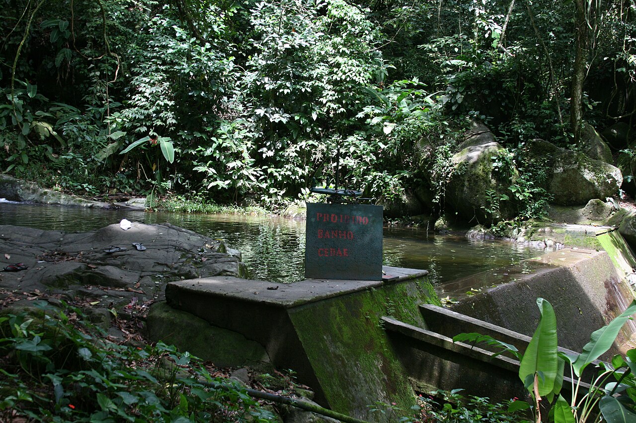
- Photograph: Parque Estadual da Pedra Branca – Pau da Fome 04 — Halley Pacheco de Oliveira, CC BY-SA 4.0 ↗
Pau da Fome reservoir photograph, resized and cropped for the hero. Shared under Creative Commons Attribution-ShareAlike 4.0; the license is linked on the file page.
- Creative Commons Attribution-ShareAlike 4.0 International license ↗
The hero photograph is shared under this license and has been resized for the page.
Keep planning
Things to Do in Rio
Compare the city’s major attractions, nature days and cultural experiences.
Best Hikes in Rio
Compare city hikes by effort, setting and the guide support each route needs.
Pedra Bonita and Pedra do Telégrafo
Plan the specific viewpoints and trail access for these West Zone hikes.
Rio Buses and BRT
Use current route information to plan the trip to your selected park entrance.
West Zone Beaches Without a Car
Plan a separate coast day and solve the last mile to its beach entrance.